Designing Smart Cities through Data-Driven Simulation
Issue #11
I’m Vignesh Kaushik. I curate and write articles on Thank God It’s Computational to help architects, designers, and urban planners leverage cutting-edge technologies on AEC projects.
TGIC is a community-driven platform providing concise technology education to students and professionals in the AEC industry to learn at their own pace. If you’re not a member, consider joining the community and supporting our work.
Urban Simulation Platforms
CityScope: Using LEGO for Rapid Urban Prototyping
MIT’s Changing Places initiative has developed CityScope, an urban simulation tool that integrates physical representation—using Legos—with projections and visualization tools. Using augmented reality decision support systems (ARDSS), users can see the impacts to be expected from shifting density by manipulating the Legos, or by setting different rules for infrastructure and mobility systems. The in-person visualization tool thus helps planners and stakeholders predict, quantify, and visualize the outcome of urban transformation. You can read more about the technology here.

Video of Land Use and Transportation Simulator using LEGO
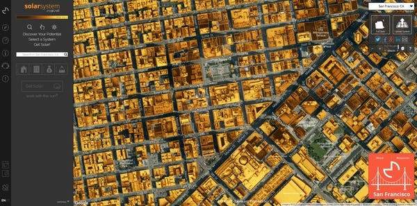
Mapdwell: Rooftop Solar Mapping Tool
Mapdwell Solar System is an interactive online rooftop solar mapping tool. It allows users to precisely estimate rooftop solar electric potential (PV panels) for almost every building in a given city by a simple click or by inputting an address. The tool uses three-dimensional elevation data to create a surface model of the sample terrain that accounts for the shape of building rooftops and structures, existing infrastructure, and tree foliage. Validation tests have shown that it yields results with a ±5% margin of error.

Umi: Environmental Performance of Buildings and Cities
Umi is a Rhino-based design environment for architects and urban planners interested in modeling the environmental performance of neighborhoods and cities with respect to operational and embodied energy use, walkability and daylighting potential.

UrbanSim: Simulation of Urban Design Scenarios
UrbanSim allows users to run simulations, draw from a library of open data, and produce visualizations. The program, which is free and open source as part of the Urban Data Science Toolkit, is designed to help planners understand the diverse impacts that might be expected from new forms of street design, mixed use zoning, or policies to promote urban density. The UrbanSim Cloud Platform is being released in early 2017 for worldwide use in local and metropolitan planning applications.

What goes into the urban simulation model? An example from UrbanSim.
Zofnass Information Tool: Understanding Urban Water Systems
The Zofnass Information Tool is a framework for data-driven insights at the intersection of water management, planning, and public policy. It was developed in Chelsea, MA, to help it’s citizens understand opportunities for water management improvements—like green roofs and porous pavement—and estimate the environmental benefits from these interventions. It is an open web tool that focuses on the relations between the water supply, stormwater, wastewater, and the urban environment as a whole.

Gaming for Sustainable Future
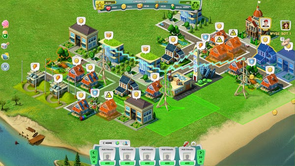
Plan it Green: Browser-based Urban Planning Game
You’ve been elected the Mayor of your hometown and have decided to take the barren environment and Plan it Green! Bring back the natural beauty of your city, and create a brighter, cleaner future. Build eco-homes and apply green upgrades, all while bringing new clean jobs and industry to your city. Increase your Greendex as you leave behind the ways of the past and create a beautiful, sustainable metropolis! Pick the latest eco-upgrades and transform your city!

And One More Thing…
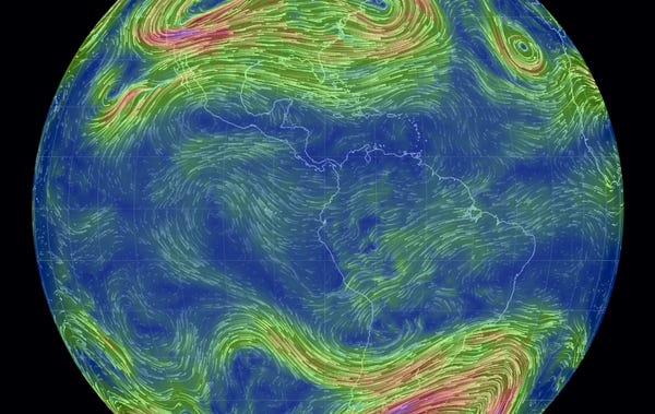
Earth: Stunning Visualization of Wind, Weather and Ocean Conditions
The most stunning aspect of this interactive map is its detail. You can change the altitude to look at winds in different layers of the atmosphere. Clicking on the “Earth” button will present a host of options for showing different map projections or data overlays. In addition to wind, you can look at ocean currents, temperature, humidity, air density and more. You can also change the time to examine extreme past weather events like Superstorm Sandy, or go forward to look at future forecasts.

Global weather conditions forecast by supercomputers updated every three hours

